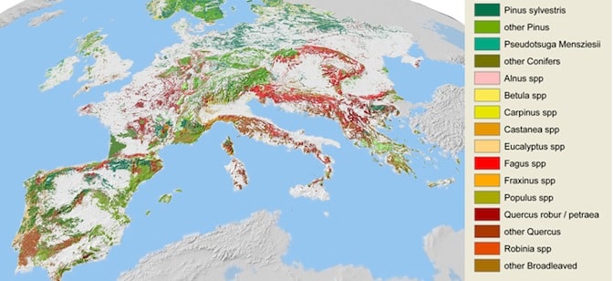
New maps of European forests show an unprecedented level of detail that can be used for studying CO2 concentrations and long term climate trends.
The European Forest Institute and Alterra (a “research institute for our green living environment” at Wageningen University in The Netherlands) plotted 20 tree species at a 1x1km level across Europe. Using GIS data, forest inventory statistics, and regression models the initiative was also able to extend the analysis to additional countries.
The resulting maps are the first time researchers have been able to study the range of tree species across Europe at this scale. EFI and Alterra assert that the maps will play an important role in future resource studies, such as carbon analysis in particular.
Learn more about the maps and request access to the GIS geodatabase here.
Image from EFI virtual library.


